|
The
Town Centre
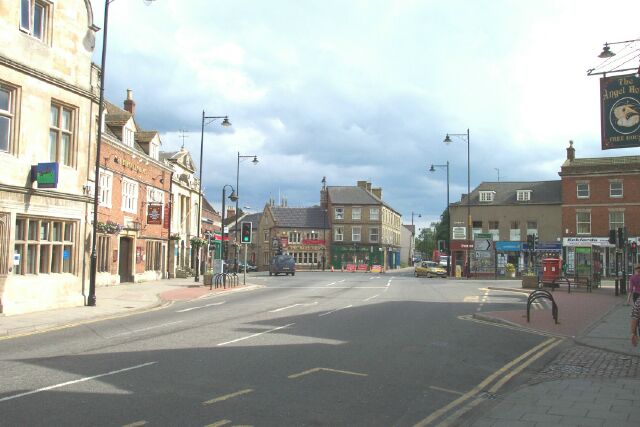
The four main streets of Bourne, North Street, South Street, West Street and Abbey Road, converge in the town centre. It was once the market place, the hub of the community, scene of sheep fairs, processions, regimental marches and various gatherings, not least the celebrations to mark Queen Victoria’s Diamond Jubilee in 1897 and the proclamation of King George V from the steps of the Town Hall in 1910.
For centuries, a friar’s cross stood on the west side of the market place. It was eight-sided and the richly carved shaft was 10 ft high on a base above threes steps. It was regarded as a place of sanctuary and was used for making proclamations and sometimes for preaching to the people of Bourne. In 1782, John Wesley, the English evangelist and founder of Methodism, stood on its steps to preach his new message of hope which heralded a movement of moral and social reform in the British Isles. The cross was taken down in 1803 but in 1860, a large ornamental drinking fountain was erected in the market place in memory of the Victorian philanthropist John Lely Ostler who had died the previous year (see The Ostler Fountain). It ceased to function as a fountain soon after its installation but the monument remained in place until 1960 when its interference with the increasing flow of vehicles through the town centre necessitated its removal and it can now be seen in the town cemetery in South road.
|
|
|
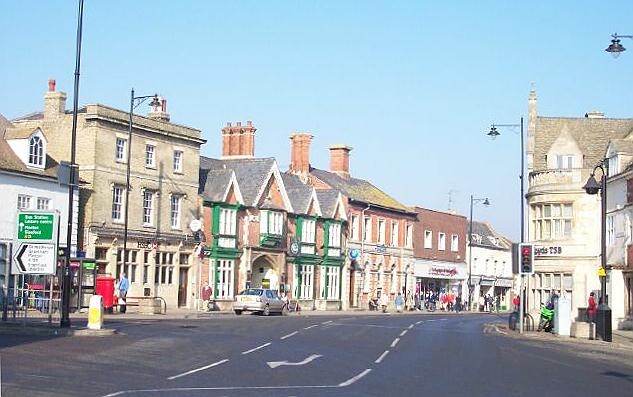
The
town centre (above), looking towards Abbey Road, pictured in June 2002
when South Street was partially closed after a lorry collided with
a roadside house two weeks before, hence the red diversion and
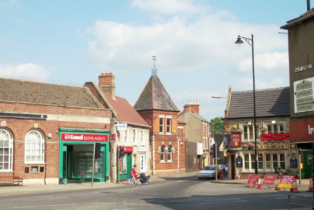
warning signs. The picture below shows the town centre looking
southwards with the Nag's Head public house in the centre
between Abbey Road and South Street.
|
|
Traffic flows at this point continued to cause concern and crossing the road is now a most hazardous undertaking. Various schemes have been tried to regulate the traffic flows at this most dangerous intersection which is currently controlled by traffic lights with a central island protected by metal barriers for pedestrians caught while crossing West Street but there are still accidents, usually involving heavy vehicles that should have been banned from using this route long ago. The most obvious solution to maintain the through flow of traffic has
not occurred to the county highways department and that is a roundabout that would cut the queues of vehicles waiting at the various sets of traffic lights at a stroke as it has at problem junctions in many towns twice the size of Bourne.
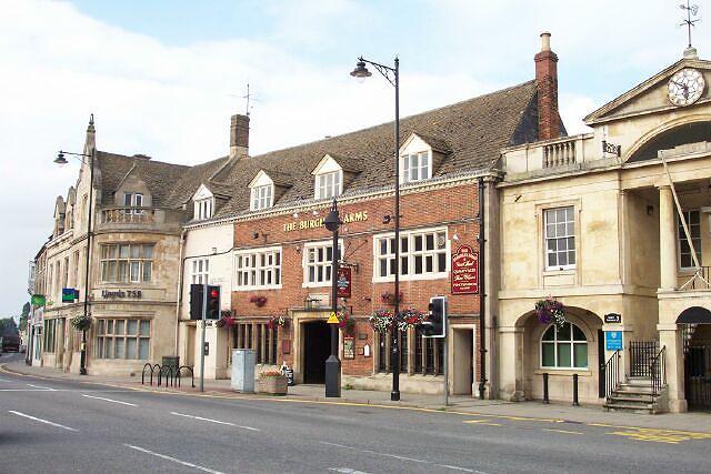
The
town centre contains one of the most attractive facades in Bourne, showing
the Burghley Arms, an ancient hostelry dating back to Elizabethan times (centre),
the Town Hall, built in 1821 (right), and Lloyds Bank plc, a fine example
of late Victorian gothic architecture (left).
|
|
|
|
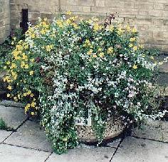
SAY IT WITH FLOWERS
Flower tubs were introduced in the town centre during the summer of 2000
(left) in an attempt to bring a splash of colour to the main streets. The scheme was organisded by the Bourne Chamber of Trade and Commerce as one of the initiatives of the Town Centre Management Partnership that was launched at the beginning of the year with the intention of bringing fresh impetus to the town centre. The ten tubs are sponsored by local businesses and looked after free by the Social Education Centre whose members regularly plant them with fresh flowers in summer and winter.
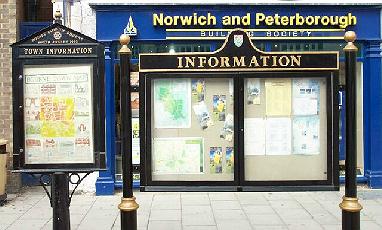
Cast iron information boards such as these (right), finished in
black and gold lacquer, can be found in all towns within the South
Kesteven District Council area. Here in Bourne, they contain a map
of the town and the location of some of our attractions together
with notices of coming events of interest to both residents and
visitors. They are located outside the Norwich and Peterborough
Building Society offices on the west side of North Street. |
|
STREET NAMES OF PAST
TIMES
Mediaeval Bourne was
clustered around the market place that we know today as the town
centre. In 1380, just seven main streets existed and any other
parts of the town were merely cart tracks or footpaths. They were:
Northgate
Southgate
Water
Gang Street
West
Street
East
Street
Manor
Street
Potter
Street
The numbering of houses and naming of streets was not introduced in England until 1805 when they could be widely read as a result of the improvement in the standard of education and the new regulations were enforced by the police. The numbering was often taken from the principal or most popular tavern or inn in that street, a system of location that had already been in use in previous centuries. |
UPDATED JULY 2003

Go to:
Main Index Villages
Index
|